Where Karalee’s
tap water comes from.
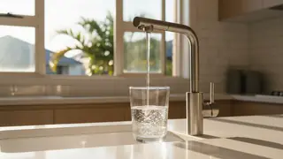
Homes in the built-up parts of Karalee are on the Urban Utilities network, supplied from Seqwater’s Mt Crosby plants. Many of the larger blocks run on rainwater tanks and bores. Every connected home in the city gets it the same way: water released from Wivenhoe Dam travels down the Mid Brisbane River to Mt Crosby, Seqwater’s East Bank and West Bank plants treat it, and Urban Utilities pumps it through its Ipswich reservoirs to your meter. Seqwater reports on the City of Ipswich zone every month. The headline figures are in the table below.
Seqwater adds two things on purpose. The first is chloramine, a disinfectant that holds a residual longer than plain chlorine over the long mains out to Karalee. It is also why a standard carbon jug does less than people expect. The second is fluoride, dosed to a target of 0.8 mg/L under Queensland law. Fish keepers need to neutralise the chloramine. Anyone on home dialysis should talk to their unit about filtration.
Tank water in Karalee is another thing entirely. Rainwater is soft and slightly acidic, it carries whatever is on the roof, and only the owner treats or tests it. Queensland Health advises a first-flush diverter on the downpipe, clean gutters, a sealed tank with screened inlets, and treatment before drinking. Bore chemistry varies from one bore to the next, so bore water needs a laboratory test before anything else.
Mineral spike after heavy rain, 20 November 2024. Treated water from the Mt Crosby plants recorded total dissolved solids of 700 and 730 mg/L (guideline 600), chloride of 270 and 300 mg/L (guideline 250) and hardness of 250 mg/L (guideline 200) after a significant rainfall event pushed natural mineral concentrations up in the Mid Brisbane River. Five aesthetic guideline exceedances, no health exceedance. Seqwater Drinking Water Service Annual Report 2024–25
How hard is the water in Karalee?
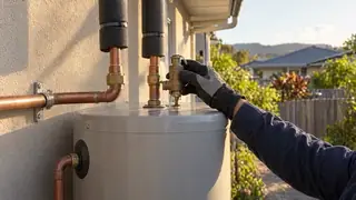
Network water here is moderately hard: 80–115 mg/L as CaCO₃, against an aesthetic guideline of 200 mg/L. It spiked to 250 mg/L in November 2024 after heavy rain washed minerals into the Mid Brisbane River. You see it as scale on kettles and shower screens. It costs most on hot water elements and heat exchangers. Scale protection on the feed is worth fitting to a hot water system in Karalee. A whole-house softener is usually more than this water needs. Hot water systems in Karalee ↗
The pH is going up
Seqwater is lifting the pH of water leaving Mt Crosby from about 7.8 to a target of 8.4 from mid-August 2026, to extend disinfection in warm months, raise alkalinity and reduce corrosion in the network. The change covers Brisbane, Ipswich, Logan, Moreton Bay and parts of the Scenic Rim. In Karalee homes, copper pipes and brass fittings corrode less in slightly more alkaline water. Hot water systems will scale a little more. Fish keepers should re-check their tank water after the change.
What the pipes in Karalee add
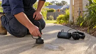
Acreage plumbing in Karalee means long service lines, a pressure pump and, on many properties, a tank between the roof and the tap. Each one gives sediment a place to settle and biofilm a place to grow. A pump that cycles constantly usually means a leak somewhere in the run. Bore water has its own chemistry. It is often hard, sometimes high in iron or manganese, and needs a laboratory test before anyone treats it.
The 2021 Census counted 1,807 private dwellings in Karalee, 98% of them separate houses. About 13% of households rent. Everyone else owns the plumbing between the meter and the tap, and most of what follows is about that stretch.
The Brisbane River: where Karalee’s water goes
The tidal Brisbane River below Mt Crosby Weir, plus the creeks that feed it from eastern Ipswich: Woogaroo, Six Mile, Goodna and Opossum. Greater Springfield, Goodna, Redbank Plains and the riverside acreage suburbs drain here. Karalee’s stormwater reaches the Brisbane River.
Healthy Land & Water rated the Lower Brisbane River catchment “Poor” for environmental condition in the 2025 Report Card, with social and economic benefits rated very high. The 2025 Report Card notes nitrogen concentrations rising in the Brisbane estuary and a general decline in catchment condition across the region since 2021. 2025 Report Card ↗
The 2011 and 2022 floods reached low-lying parts of Karalee, and Council’s historical flood mapping shows how far. Floodwater is untreated river and creek water carrying sewage, fuel and silt. What it leaves in drains, gullies and rainwater tanks stays long after the water drops. A tank that went under needs emptying and cleaning. A hot water system that went under needs checking before anyone uses it. Council flood mapping ↗
The Queensland Government monitors the tidal Brisbane River below Mt Crosby Weir through its estuarine ambient water quality program. The freshwater gauge network does not cover it. Water Monitoring Information Portal ↗
Where the wastewater goes
Karalee is largely unsewered. Wastewater goes to a septic tank or an on-site treatment system on each block. When one fails, the nutrients and bacteria go into the soil, the nearest gully and the Brisbane River. Council regulates on-site systems and some work on them needs a licensed installer. If you have a bore and a septic system, check the distance between them first.
Sources: Seqwater monthly water quality report, City of Ipswich zone · Seqwater Drinking Water Service Annual Report 2024–25 · Seqwater: pH level of drinking water enhanced in parts of South East Queensland · Urban Utilities: Water hardness · Healthy Land & Water Report Card 2025: Key Messages & Catchment Summaries · Ipswich City Council flood mapping · ABS 2021 Census QuickStats. Figures are for the City of Ipswich supply zone; Seqwater and Urban Utilities do not publish results by suburb. Housing descriptions are general observations about the suburb and do not describe any individual property. Data last updated 2026-10-01.